How Sentinel‑1C Is Shaping the Future of Radar Imaging
Why the next Sentinel satellite matters
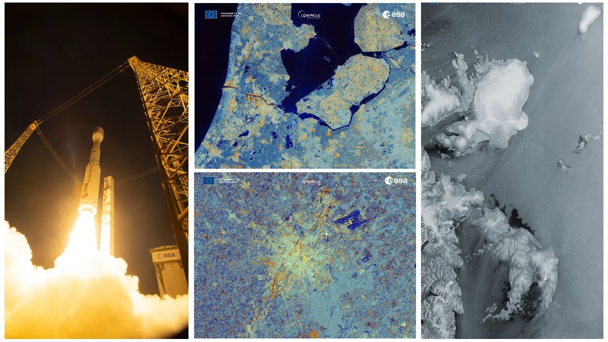
When the first Sentinel‑1 satellite lifted off in 2014, it proved that synthetic aperture radar (SAR) could deliver reliable, all‑weather Earth observations at a global scale. Six years later, Sentinel‑1B joined the pair, halving the revisit time and cementing a new standard for monitoring everything from flood plains to polar ice. The upcoming Sentinel‑1C is poised to push that standard even further, promising higher resolution, more frequent passes, and a suite of technical tweaks that could reshape how scientists and responders rely on radar data.
What upgrades does Sentinel‑1C bring?
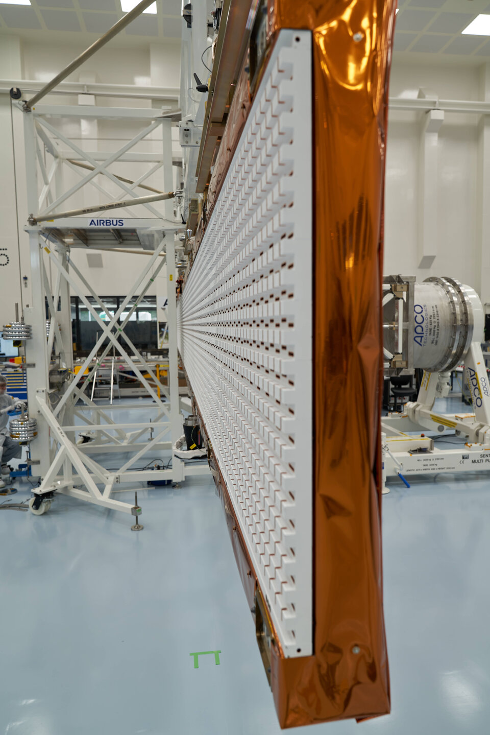
Although ESA has kept many details under wraps, the design philosophy is clear: build on the proven C‑band SAR payload while addressing the limitations that have emerged over a decade of operation. Anticipated improvements include:
- Finer spatial resolution – early studies suggest a modest boost, enabling features as small as a few metres to be distinguished more reliably.
- Shorter revisit cycles – with a third satellite in the constellation, the nominal global coverage could drop from 12 days to around 4‑5 days for any given spot.
- Enhanced polarisation modes – dual‑polarisation is already standard, but Sentinel‑1C may add additional acquisition modes that improve surface‑characterisation algorithms.
- Improved onboard processing – smarter compression and faster data downlink mean users receive usable products sooner, a critical factor for emergency response.
These changes aren’t radical departures; they’re incremental refinements that together create a more responsive and detailed radar imaging service.
Real‑world impacts across sectors
Radar’s ability to see through clouds and darkness makes it uniquely valuable for a host of applications. Sentinel‑1C’s tighter revisit and sharper images could amplify those benefits in several ways.
Agriculture
Farmers already use Sentinel‑1 data to gauge soil moisture and detect early signs of crop stress. With more frequent snapshots, growers could monitor irrigation efficiency on a near‑daily basis, adjusting water use before a drought escalates.
Disaster management
During floods, landslides, or volcanic eruptions, optical satellites often struggle with cloud cover. A faster‑refresh SAR feed would let authorities map inundated areas in near‑real time, prioritize evacuations, and allocate relief resources more precisely.
Sea‑ice and ocean monitoring
Arctic research relies heavily on SAR to track sea‑ice drift and thickness. Sentinel‑1C’s higher resolution could reveal subtle changes in ice edge dynamics, improving climate models and navigation safety for polar vessels.
Deforestation and land‑use change
By detecting minute alterations in backscatter, SAR can identify illegal logging activities even under dense canopy. More frequent observations would shrink the window between an illegal cut and its detection, enhancing enforcement.
How Sentinel‑1C fits into the broader Earth‑observation ecosystem
Radar isn’t a solitary player. It complements optical missions like Sentinel‑2, thermal sensors such as Sentinel‑3, and upcoming constellations from commercial providers. The synergy lies in data fusion: combining SAR’s structural information with optical colour and thermal temperature yields richer, multi‑dimensional insights.
For example, a wildfire analyst might overlay Sentinel‑1C’s burn‑scar maps with Sentinel‑2’s vegetation indices to assess both the extent of damage and the underlying fuel loads. Similarly, urban planners could merge SAR‑derived surface deformation data with high‑resolution optical imagery to monitor subsidence in rapidly growing cities.
Challenges ahead and the road beyond Sentinel‑1C
While the promise is exciting, a few practical hurdles remain. The sheer volume of data generated by a three‑satellite SAR constellation demands robust ground‑segment infrastructure and efficient cloud‑based processing pipelines. Moreover, interpreting SAR signals still requires specialised expertise; broader user adoption hinges on user‑friendly tools and training programmes.
Looking further ahead, ESA and its partners are already discussing “Sentinel‑1‑Next,” a potential fourth satellite that could incorporate L‑band or even dual‑frequency SAR to capture deeper penetration into vegetation and soil. Such advances would close the gap between radar and ground‑based measurements, opening doors to new scientific questions.
FAQ
What is Sentinel‑1C?
Sentinel‑1C is the planned third satellite in ESA’s Sentinel‑1 SAR constellation, designed to extend and enhance the all‑weather imaging capabilities of its predecessors.
When is it expected to launch?
Current timelines point to a mid‑2020s launch, though the exact date will depend on final testing and integration schedules.
How does SAR differ from optical imaging?
SAR emits microwave pulses and measures the echo, allowing it to see through clouds, smoke, and darkness, whereas optical sensors rely on reflected sunlight and are hampered by weather and night‑time conditions.
What new capabilities can users anticipate?
Users can look forward to finer spatial detail, more frequent revisits (down to about four days globally), and additional polarisation modes that improve surface classification and change‑detection accuracy.