How to Choose the Best Weather Radar App (OS/NOAA) for Android
When a storm suddenly rolls in, you don’t have time to scroll through endless tables. A good radar app puts the storm’s edge right on your screen, letting you decide whether to grab an umbrella or postpone a road trip. Android users are spoiled for choice, but not every app treats NOAA’s data with the respect it deserves.
Why NOAA‑Based Radar Is the Gold Standard
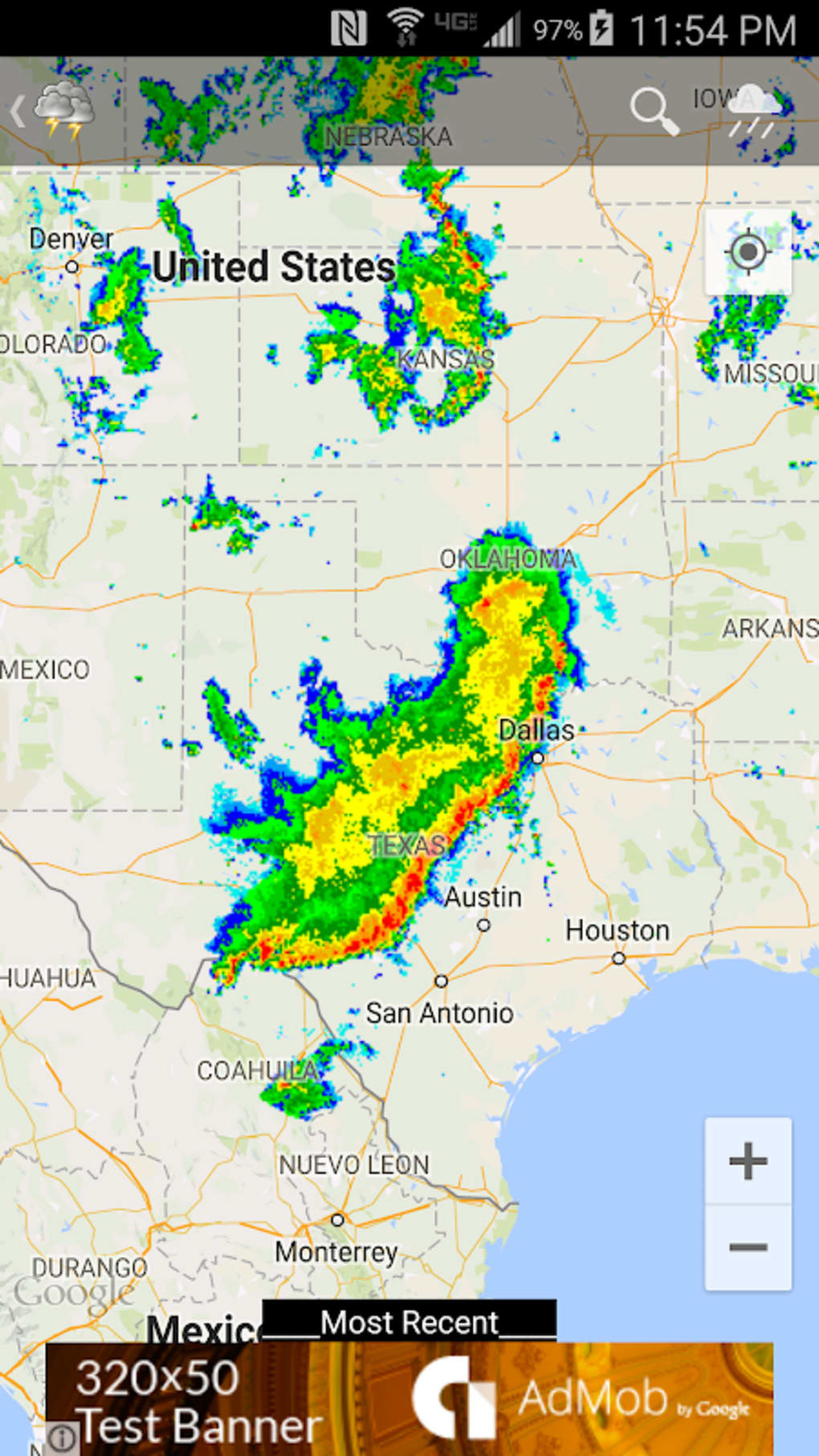
NOAA (the National Oceanic and Atmospheric Administration) runs the nation’s most comprehensive radar network. Its WSR‑88D stations spit out updates every few minutes, meaning the imagery you see is practically live. Apps that simply pull a static satellite picture can’t match that level of detail.
That said, the raw radar feed can be a mess without proper processing. The best Android radar tools clean up the noise, overlay storm motion vectors, and let you zoom to a street‑level view without losing resolution.
Top Android Radar Apps That Harness NOAA Data
Below are four contenders that consistently receive high marks from both casual users and meteorology enthusiasts.
- RadarScope – A favorite among storm chasers, RadarScope offers layered reflectivity, velocity, and storm‑track overlays. Its subscription unlocks high‑resolution NEXRAD data directly from NOAA.
- MyRadar Weather Radar – Known for its sleek interface, MyRadar provides animated radar, severe‑weather alerts, and a “storm tracker” that follows a storm’s path automatically.
- Storm Radar (by WeatherBug) – Offers a blend of radar and lightning strike maps. The “Storm Cell” view highlights updrafts and hail potential using NOAA’s dual‑pol data.
- NOAA Radar Pro – A no‑frills app that pulls the raw NEXRAD feed and adds simple controls for intensity thresholds, making it a solid choice for those who want data without the bells and whistles.
Key Features to Prioritize
Not every radar app is built the same. When you’re comparing options, keep an eye on these essentials.
Refresh Rate
Storms evolve quickly; a 15‑minute lag can turn a watch‑and‑wait situation into a missed warning. Look for apps that update at least every five minutes.
Adjustable Intensity Thresholds
Being able to set the dBZ (decibel Z) level helps you filter out light rain and focus on truly severe convection. Most power users toggle between 30 dBZ (light rain) and 55 dBZ (tornado‑potential).
Multi‑Layer Overlays
Combining reflectivity with velocity and storm‑track layers gives a three‑dimensional picture of what’s happening aloft. It’s especially handy when you’re trying to differentiate between a gust front and a true tornado vortex.
Alert Integration
Push notifications that pull directly from the National Weather Service (NWS) are more reliable than generic “storm alerts” you might get from a weather website.
How to Fine‑Tune Radar Accuracy on Your Device
Even the finest radar can look fuzzy if your phone’s settings are off. Here are a few quick tweaks.
- Enable high‑accuracy location in Android’s Settings → Location → Scanning. Accurate GPS gives the app the correct map tile alignment.
- Turn off battery‑saving modes that limit background data. Radar apps need a steady stream of small packets.
- If your device supports it, switch to LTE/5G instead of Wi‑Fi‑only. Cellular networks often have lower latency for the rapid updates NOAA provides.
Understanding the Limits of Radar
No radar can see through mountains or the curvature of the Earth. A radar beam that’s 90 km away can be over 2 km high, meaning low‑level tornadoes might be missed if they’re tucked under the beam’s elevation.
That’s why many of the top apps supplement radar with dual‑pol data (dual‑polarization) and storm‑track algorithms. Those extra data streams help infer hail size and even differentiate between rain and snow.
When to Trust the App—and When to Double‑Check
Radar apps excel at showing where precipitation is occurring now, but they don’t predict the future. Pair your radar view with a forecast discussion from the NWS or a reputable meteorology blog if the thunderstorm looks ominous.
If an app screams “tornado warning” but the official NWS site shows none, treat it as a heads‑up to stay alert rather than an absolute confirmation.
Tips for Real‑World Use
Here are some habits that turn a good radar app into a reliable sidekick.
- Bookmark the “nearest radar site” screen. Knowing which NEXRAD station covers your area lets you gauge coverage gaps.
- Set custom alert zones. Most apps let you draw a polygon around your home or workplace, ensuring you get notifications only for the areas that matter.
- Use the “rain‑cumulative” feature (if available) to see how much rain has fallen over the past hour—handy for gardeners and event planners alike.
And finally, keep the app updated. NOAA occasionally upgrades its data format, and an outdated app might misinterpret the newest packets.
Wrapping Up the Decision Process
Choosing the best NOAA‑powered radar app for Android isn’t about chasing the flashiest UI; it’s about finding a tool that delivers near‑real‑time data, flexible overlays, and reliable alerts. Test a couple of the options above, tweak the settings to suit your location, and you’ll have a weather companion that feels almost like a personal forecaster.