How Geoimgr Tool Becomes Your Ultimate Image Geotagging Solution
Ever stared at a collection of photos and wondered exactly where each snap was taken? That vague curiosity often turns into a practical need—whether you’re a travel blogger, a real‑estate photographer, or just a hobbyist who loves to map memories. Enter Geoimgr, a tool that promises to turn ordinary pictures into precise geographic breadcrumbs.
What Is Image Geotagging, Anyway?
In plain terms, geotagging embeds latitude, longitude, and sometimes altitude into a photo’s EXIF metadata. Think of it as attaching a tiny GPS pin to every image. When you upload those pictures to services like Google Photos or Flickr, the platform can automatically place them on a map.
Historically, you needed a dedicated GPS‑enabled camera or a separate app to add coordinates after the fact. Today, software like Geoimgr takes the guesswork out of the process, letting you batch‑process hundreds of files in minutes.
Why Geoimgr Stands Out
There are plenty of geotagging solutions, but Geoimgr distinguishes itself in three practical ways.
- Bulk Processing Power – Upload a whole folder, select a time‑range, and let the engine match each shot to the nearest GPS log.
- Smart Accuracy Filters – The tool automatically discards outliers when satellite signals were weak, reducing erroneous tags.
- Cross‑Platform Flexibility – Works on Windows, macOS, and even Linux without a heavy install; just a portable executable.
These features translate into a smoother workflow, especially when you’re dealing with vacation albums or field‑survey images.
Core Features Worth Noticing
1. Automatic GPS Log Matching
Geoimgr reads GPX, KML, or even plain CSV logs from your smartphone, dashcam, or handheld GPS. By aligning timestamps, it guesses the most probable location for each photo. The algorithm also accounts for time zone offsets—a small detail that can otherwise throw everything off by several hours.
2. Manual Override with Interactive Map
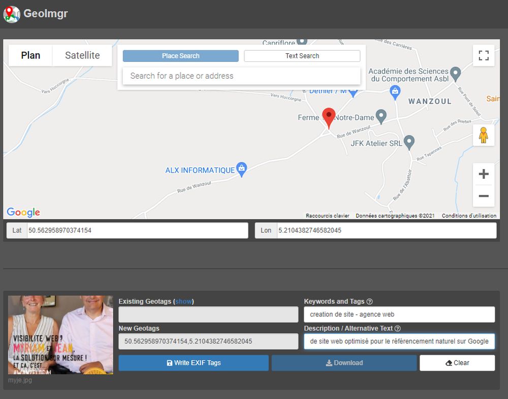
If the automatic match feels off, you can open an integrated map view. Click a point, drag a pin, and the new coordinates instantly replace the old ones. It’s surprisingly intuitive, even if you’ve never fiddled with EXIF data before.
3. Privacy‑First Export Options
When you need to share images without revealing exact coordinates, Geoimgr offers a “blur location” mode. It either rounds coordinates to the nearest kilometer or strips them entirely, depending on your preference.
Getting Started in Five Simple Steps
- Download and Launch – Grab the latest version from the official site; no installer required.
- Import Your Photos – Drag‑and‑drop a folder or select files via the browse button.
- Upload a GPS Log – Choose the file that recorded your journey; Geoimgr supports most popular formats.
- Review & Edit – Scan the auto‑matched list, correct any mismatches on the map, and set privacy options.
- Export – Save the newly tagged photos to a destination folder, ready for upload or archiving.
Even if you’re a total novice, the step‑by‑step wizard guides you through each phase. The learning curve feels more like a friendly tutorial than a tech manual.
Tips for Getting the Most Accurate Tags
- Synchronize your camera’s clock with your phone before heading out. Even a few minutes’ drift can misplace a photo on a long trek.
- Prefer GPS logs recorded at least once per second for better granularity.
- When traveling across time zones, capture a quick “time‑stamp” photo of your phone’s clock.
- If you’re using a separate GPS device, export the log in GPX format for seamless ingestion.
Applying these habits doesn’t guarantee perfection—nature, tunnels, and skyscrapers sometimes block satellites—but it dramatically improves the odds of a clean match.
Common Questions About Geoimgr
Is the tool free? The basic version is free and covers most casual needs. A Pro license unlocks batch‑processing on unlimited folders and priority support.
Can I edit existing EXIF data without re‑tagging? Yes. Geoimgr lets you view and edit any EXIF field, not just GPS coordinates.
What about RAW files? The application reads and writes GPS tags for popular RAW formats (CR2, NEF, ARW). However, always back up originals before bulk changes.
When to Reach for a Different Solution
Geoimgr shines for photographers who need quick, reliable bulk tagging. If you require advanced GIS integration—like feeding data directly into ArcGIS—or need to process millions of images nightly, a dedicated enterprise platform might be more appropriate.
Similarly, users who work exclusively on mobile devices may prefer an app that runs entirely on iOS or Android, bypassing desktop steps altogether.
Final Thoughts
Geotagging used to be a niche task reserved for professionals with specialized gear. Today, tools like Geoimgr democratize the process, letting anyone turn a simple photo album into an interactive map of experiences. By combining automated matching, manual fine‑tuning, and privacy controls, it truly earns the “ultimate” label for most everyday users.